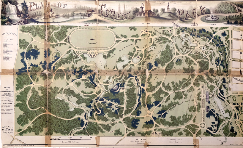
Theodore Link’s “Plan of Forest Park” (1876) is just one of scores of maps of the St. Louis region that are being catalogued, conserved and displayed for the first time at UMSL’s St. Louis Mercantile Library. It is one of many maps August Jennewein has photographed for a future Mercantile catalog.
“Each day brings me something new I get to photograph at UMSL – visual adventures so to speak,” said Jennewein, UMSL’s campus photographer. “Today, and for the last few weeks, I’ve had the pleasure to photograph historical maps in the Mercantile Library.”
A future exhibit, “Mapping St. Louis History: An Exhibition of Historic Maps, Rare Books and Images,” is part of the many area programs planned to commemorate the 250th anniversary of St. Louis’ founding. Images from the collection will be presented alongside important maps that helped forge or change the physical, intellectual and public character of St. Louis. The exhibit will open Oct. 17.
“This map, one of the most beautiful ever produced for an urban park in America, serves as a preview for the university community of which the Mercantile is a vibrant part,” said John Hoover, director of the library.
The photograph is the latest to be featured in Eye on UMSL.


