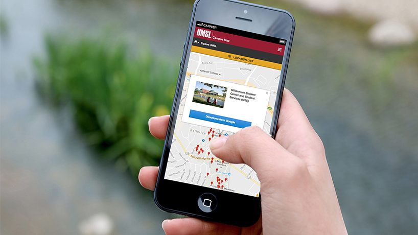
UMSL’s web team recently unveiled an improved, interactive campus map. One of the top destinations on the university website, the new version offers seamless wayfinding and also showcases campus through pop-up images and building descriptions. (Image by Lori Austin)
Spread across 470 rolling acres, the University of Missouri–St. Louis can be a lot to take in, geographically speaking. That makes a good map an especially critical resource for newcomers – and even for longtime campus community members now and then.
“The UMSL map is among the top 15 most visited webpages on our site year-round, and it cracks the top five during the first week of classes,” notes Justin Roberts, manager of the university’s web communications.
That’s a big reason that the development of a much-improved version of that online resource was deemed a priority for Roberts’ team over the last few months. Another factor was the need to update the map to reflect the significant recent growth of the campus.
In the wake of the opening of new facilities including the UMSL Patient Care Center and the Science Learning Building, the new version went live in November. It offers site visitors several new features that together provide a better user experience.
“It’s interactive, searchable and mobile-friendly,” Roberts says. “We didn’t change everything, though. Visitors can still download PDF versions of our campus maps on the site.”
In addition, the map now includes building descriptions with helpful detail as well as static images for each entry, showcasing the beauty of the campus.
Roberts credits his team with bringing the much-needed project to fruition.
“Our web developer, Fernando Sucre, and web designer, Lori Austin, built the site in-house using open-source code that ties in to Google Maps,” he says.
The new version is expected to significantly improve wayfinding for campus visitors, students, faculty and staff.
“The site works seamlessly with Google Maps to quickly and accurately get directions, whether you’re walking across campus for a class or driving to the Touhill for a performance,” Roberts says.
To start exploring the new map, visit umsl.edu/maps.html.


