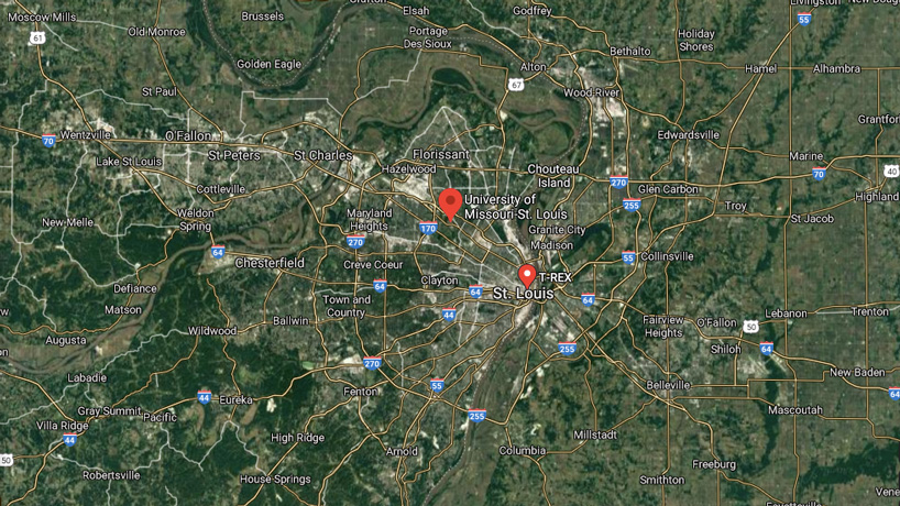
The National Security and Community Policy Collaborative will facilitate collaboration between UMSL researchers and St. Louis’ growing geospatial technology sector to support local communities and drive social change. (Screenshot)
The St. Louis region is positioned to become an epicenter for geospatial technology and innovation in the United States with the National Geospatial-Intelligence Agency’s $1.75 billion west headquarters under construction northwest of downtown and a burgeoning community of businesses sprouting up nearby.
 The University of Missouri–St. Louis is looking to take advantage of that expertise and facilitate collaboration with its own researchers with the creation of the National Security and Community Policy Collaborative.
“We are using the term ‘collaborative’ very deliberately,” said Andrew Kersten, the dean of the College of Arts and Sciences. “This new center is poised to facilitate conversations and connections among local community leaders, policy makers, and academic and geospatial ecosystem partners. Those linkages will help inform us on how to best employ geospatial technologies, the social sciences, and innovations to address community problems and drive better public policies and an even more vibrant St. Louis.”
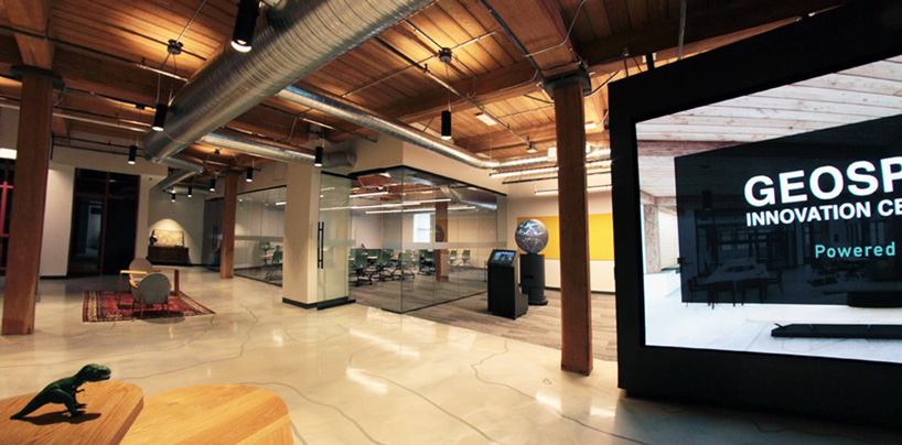
The new center, part of the College of Arts and Sciences, will be operating out of space in the Geospatial Innovation Center on the fourth floor of nonprofit innovation and entrepreneur development facility T-REX.
“We’re extremely excited to welcome UMSL as part of the T-REX family,” said Mark Tatgenhorst, the geospatial program director at T-REX. “Their commitment to advancing geospatial technology, policy and tradecraft, as well as, their commitment to the St. Louis community are in perfect alignment to the core values of T-REX.”
The National Security and Community Policy Collaborative will operate out of an office in the Geospatial Innovation Center at T-REX in downtown St. Louis. (Photo courtesy of T-REX)
Robert Ubbelohde, a retired 32-year-veteran of NGA, was hired in April to begin building the new center and serve as its founding director.
Geospatial technology has applications that extend far beyond its earliest uses as a tool for providing battlefield intelligence for military leaders.
The GeoFutures advisory committee – of which Kersten is a member – has been creating plans to bolster St. Louis’ evolving geospatial sector. It has pointed to four industries where the region could gain a competitive advantage: national security, precision agriculture, transportation and logistics, and health care delivery.
“Geospatial analysis is the science of location, time and the events that take place in this space,” Ubbelohde said. “Commercial entities can use this to determine the best locations to place a new retail outlet based on traffic flow.”
Geospatial technology can also provide valuable information to inform both physical and social science research.
“I think UMSL sees its niche in the ability to drive social change and support local communities” Ubbelohde said.
Utilizing geospatial technology and data, researchers can focus on neighborhoods to better identify some of the challenges they face. Geospatial analysis can aid in demonstrating the existence of so-called food deserts, under-resourced communities whose residents have to look elsewhere to purchase affordable and nutritious groceries. It also can help show how systemic violence is impacting neighborhoods and inform policies to address it. These are just a couple examples that speak to vulnerabilities from a broader national security perspective but have a direct impact on the health and sustainability of our communities.
Ubbelohde also points out from a physical science perspective how geospatial analysis can help with climate change and environmental concerns while improving food production.
The NSCPC is very much in its infancy. The chancellor’s cabinet only granted final approval for its creation last month.
Ubbelohde plans to hire a graduate assistant and establish an affiliate faculty program with a fellow, who will be embedded at T-REX. UMSL will be seeking grants to help it eventually expand the staff to include a research director, a geospatial analyst as well as resident fellows or post-doctoral researchers.
For now, one of Ubbelohde’s primary objectives is to explain how geospatial analysis can enhance existing or new research.
“I’ve been pleasantly surprised at the number of people that have come to me virtually and said, ‘Hey, I’ve been looking for an opportunity like this,’” Ubbelohde said. “They just don’t have the technical resources or the knowledge to get the analysis done. So, how do we bring those together? The center can really act as a liaison between the university and the opportunities through T-REX and local geospatial community to pull these together.”
The NSCPC is also looking to partner with the UMSL Department of Computer Science as well as other departments to develop certificate courses involving geospatial data science discipline.
Ubbelohde will be working to create internship opportunities for students with companies in T-REX, and he would like to partner with NGA on a summer high school internship program that would expose students from under-resourced neighborhoods to geospatial principles.

