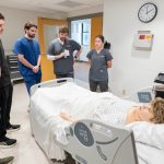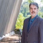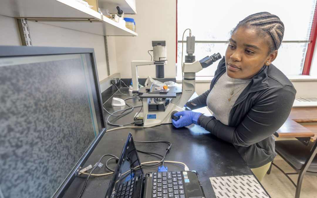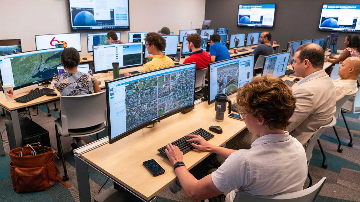
About two dozen researchers from Taylor Geospatial Institute partner organizations take part in a demonstration of Cesium ion as part of a free workshop last Wednesday in UMSL’s Geospatial Advanced Technology Lab in Benton Hall. (Photos by Derik Holtmann)
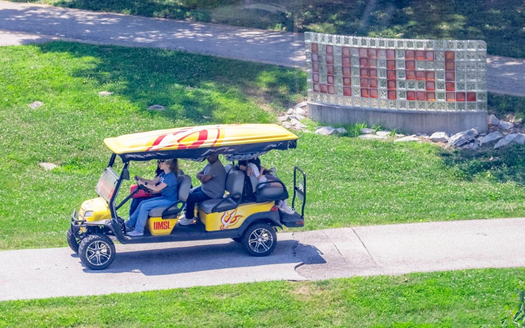
Roughly two dozen researchers from across the St. Louis region were on hand in the Geospatial Advanced Technology Lab on the fourth floor of Benton Hall last Wednesday as the University of Missouri–St. Louis hosted a free workshop put on by the Taylor Geospatial Institute.
Others tuned in online to view a demonstration of Cesium ion, a secure platform for serving geospatial data as 3D tiles that can be hosted on the cloud and streamed to any device for visualization and analysis.
The workshop doubled as an opportunity to showcase the technology tools available at UMSL for geographic information systems and virtual and augmented reality thanks to the advanced technology lab that opened at the beginning of the semester.
“The University of Missouri–St. Louis is a foundational member of TGI, and we are working collaboratively with them and the other members to grow this field,” said Reda Amer, the director of UMSL’s Geospatial Collaborative. “We are excited to show off this new space to TGI members. I can say we are the only institution here in greater St. Louis who has this. When we have something to share with other collaborators, this makes us proud of what we have.”
Researchers from TGI partner institutions such as Saint Louis University, Missouri University of Science and Technology, the Donald Danforth Plant Science Center and UMSL joined other interested practitioners taking part in the workshop.
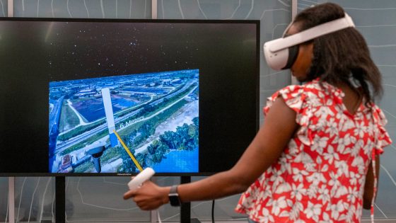
Innocencia Owuor, a postdoctoral fellow with UMSL’s Geospatial Collaborative, takes part in a virtual reality demonstration during a Cesium ion workshop put on by the Taylor Geospatial Institute last Wednesday in Benton Hall.
Representatives from Cesium led them through interactive sessions that demonstrated ways to integrate diverse datasets, create immersive 3D maps and take advantage of CesiumJS tools for spatial data visualization, analysis and storytelling.
TGI was founded in 2022 as a consortium of eight academic and research institutions with the goal of fueling research collaboration and helping establish St. Louis as a global center of geospatial excellence.
“This year has been the year of engagement at TGI,” said Jonathan Fath, marketing director for the Taylor Geospatial Institute. “We’ve been gearing a lot of our workshops, working group meetings and other activities toward actually getting out and doing more stuff with our member universities.
“This is a really interesting one. It is a 3D geospatial tools workshop that we partnered with Cesium on. It is based in Philadelphia and focuses on digital twins, 3D geospatial mapping, and it has a lot of open source tools and also unique, custom geospatial data sources. UMSL got involved with us a couple of months ago. They were happy to offer up the new lab, which has been excellent. I’m glad to see the collab space is growing so quickly.”
There is no shortage of interest in learning about and working with geospatial tools.
Sandra Arango-Caro, a senior education researcher and principal investigator at the Danforth Plant Science Center, has been leading the center’s Education Technology Program. She is hoping to use cutting-edge technology to engage and inspire students to pursue careers in science, technology, engineering and mathematics, and she attended the workshop to learn more about Cesium ion and its potential uses.
“I want to create a high school program in which the students can use the data that is generated by the scientists at the Danforth with geolocation and all kinds of features,” said Arango-Caro, who earned a PhD in ecology, evolution and systematics from UMSL’s Department of Biology in 2002. “Then the students have a more interactive way of learning because it’s not just in a lab where you follow a formula, but actually they are learning about a real problem from the scientists. They are going to be hopefully contributing their data to the scientists through their research. They are going to be learning about geospatial content, but they will also be practicing science communication, and they will have connections to applications in the real world.”
Innocensia Owuor, a postdoctoral fellow with UMSL’s Geospatial Collaborative, was excited to have the opportunity to explore Cesium ion-generated 3D geospatial models in UMSL’s virtual reality lab.
“Taking into account the development of the VR headsets that have been happening the last few years, I feel like getting more information and skills about 3D data will be useful for the future,” Owuor said.
She had a chance to examine the amount of flooding that would ensue from different water levels accumulating in Miami, Venice and St. Louis.
“It was really impressive,” Owuor said, “to use the VR set to see how bad it would get in terms of roads and how flooded it would be.”
Jim Rubenstein, a geography teacher at Fort Zumwalt North Middle School, also attended the workshop. He’s getting set to retire from teaching at the end of this school year and has been pursuing a GIS certificate from UMSL as he ponders a career change after 30 years in the classroom.
“I’ve introduced GIS to my students over the years,” Rubenstein said. “I know the basic fundamentals enough to know that I was interested in this, so that’s why I’m pursuing it.”
Rubenstein is hoping to attend other geospatial workshops this summer as he continues working toward his certificate.
“I’ve been looking for things where I can sort of tag along and watch,” he said. “It’s hard going in and doing workshops when I don’t know all the basics, but I’m just trying to get exposed. It makes it easier when you have class if you have already been presented with some of the ideas and seen some real-life applications.”
TGI is also preparing to host its first Town Hall Event happening on May 22 at the Donald Danforth Plant Science Center. It will be an opportunity to celebrate the consortium and its successes while providing updates for researchers and government and industry partners.