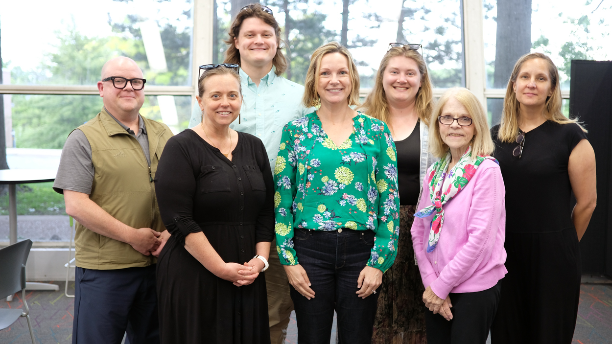
Four local educators and three College of Education faculty members (from left) Matthew Merys-Mahaffey, Dee Dawson, Ben Breuer, Shea Kerkhoff, Ava Hughes, Sarah Coppersmith and Allison Antink-Meyer gathered at the Ed Collabitat on April 30 to launch UMSL’s Geospatial Workforce Pathways Advanced Workshop. (Photos by Burk Krohe)
Students in Ava Hughes’ environmental science class at Clayton High School have become well acquainted with National Geographic’s MapMaker over the past two years.
The digital map-making tool, which was created through a collaboration between the National Geographic Society and Esri, brings the world’s natural wonders to the classroom and makes Hughes’ lessons highly interactive.
“I use it all the time in my classroom because it helps to conceptualize things,” Hughes said. “Where are volcanoes in the world? And how does that fit with things like earthquakes and tsunamis?”
Meanwhile, in Dee Dawson’s classroom at Christ Community Lutheran School, students have used ArcGIS StoryMaps, another digital map-making tool, to plot the locations of animal shelters in Missouri and correlate them with a range of variables. Dawson also helped launch the inaugural Aerial Drone Competition last month, which hosted 22 middle and high school teams from across the state.
Hughes and Dawson represent a class of forward-thinking educators beginning to integrate geospatial technology and literacy throughout the school day. Their experience in this arena made them perfect candidates to join the Geospatial Workforce Pathways Advanced Workshop at the University of Missouri–St. Louis.
The project is bringing together local educators with geospatial experience to develop model ArcGIS StoryMaps centered on St. Louis’ natural assets and cultural landscapes that other educators can then use in their classrooms. Additionally, the StoryMaps will help bring students outside of the classroom into St. Louis area communities to gather data, and their findings can then be applied to local challenges.
The innovative, interdisciplinary program is facilitated by faculty members in the UMSL College of Education and is funded as part of the new $5 million Geospatial Workforce Development Pilot Program. The National Geospatial-Intelligence Agency contracted the UMSL Geospatial Collaborative, under the leadership of Director and Principal Investigator Reda Amer, to develop the pilot project with the aim of strengthening the nation’s geospatial workforce by building intentional education and career pathways that begin well before college.
A group of College of Education faculty members including Allison Antink-Meyer, the E. Desmond Lee Endowed Professor in Science Education; Shea Kerkhoff, associate professor of literacy; and Sarah Coppersmith, scholar in residence and affiliated faculty member with the Geospatial Collaborative and Pierre Laclede Honors College, responded to a request for proposals from the collaborative and secured $30,000 for the initiative. The funding provides a stipend to each participant and also covers the cost of attending the 2026 Esri User Conference as well as one novice workshop for preservice teacher candidates.
On April 30, Hughes and Dawson joined fellow educators Matthew Merys-Mahaffey and Ben Breuer for the Advanced Workshop’s kickoff meeting in the Ed Collabitat on UMSL’s South Campus. Merys-Mahaffey, a humanities teacher at Christian Brothers College High School and an UMSL alum, jumped at the chance to gain more experience with GIS – or geographic information systems – tools. He has long been interested in educational technology and sees geospatial as the future of K-12 education.
“There will be a time when, if we do it the right way, bringing geospatial literacy across all of our disciplines, can make it so that the teacher says, ‘One option is to write the essay. Another is, how do you express that in a different way, using mapping software?’” Merys-Mahaffey said. “That’s how we’re approaching this.”
Breuer, a substitute teacher working toward his MEd at UMSL, agreed and is excited by the possibilities offered by the multi-modal nature of the technology.
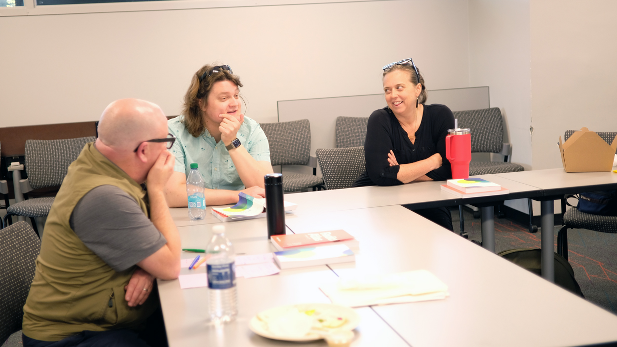
Advanced Workshop members (from left) Matthew Merys-Mahaffey, Ben Breuer and Dee Dawson bounce ideas off each other during the group’s inaugural meeting.
“GIS technologies, it’s not just a linear point-by-point hypothesis,” Breuer said. “It’s actually incorporating all this different type of data, whether it’s pictures, videos, even something like water levels.”
Antink-Meyer said the College of Education team developed the workshop with an interdisciplinary approach in mind.
“We want kids to not just engage with some technology and with some place-based questions, but we want them to think about what that communication looks like,” Antink-Meyer said.
ArcGIS StoryMaps is an ideal medium to do so. ArcGIS is Esri’s primary suite of geospatial software, and StoryMaps allows users to combine maps, 3D scenes, embedded content, multimedia and more into an interactive narrative. Kerkhoff noted there’s an element of literacy inherent in geospatial technologies.
“We’re natural storytellers, but we have developed these complex ways of telling stories that are rich and layered, so different people can tell stories in a way that their brain works,” she said. “What I love about StoryMaps is it combines the words, the visuals and the numbers to tell a story.”
For instance, in Coppersmith’s honors course, Geospatial Investigations: Mapping St. Louis to the World, students created StoryMaps focused on last year’s May 16 tornado. One group examined how the destruction impacted the physical environments – such as the number of trees uprooted and trees subsequently replanted – in different neighborhoods, while another investigated how land use in different areas correlated with the resulting devastation. Students went into the field – Clayton and north St. Louis – to collect data and create illuminating narratives about a timely social issue.
“They took their own photographs and wrote about it,” Coppersmith said. “It really was impactful to them.”
Breuer, Dawson, Hughes and Merys-Mahaffey will develop their own topics and draft an outline of their StoryMaps over the next two months. The group will meet twice more to receive support from UMSL faculty and refine their projects. In July, they’ll attend the 2026 Esri User Conference in San Diego to expand their ArcGIS skills and network with other educators integrating geospatial lessons into their classrooms. In August, they’ll submit their final StoryMaps before presenting them to UMSL education majors in September.
Kerkhoff hopes the Advanced Workshop will serve as a launching pad for similar projects and as a model to help create a geospatial workforce pipeline, where students can stay in the region and go on to careers in a growing, cutting-edge field.
For now, she’s excited about what the cohort will accomplish over the summer.
“I’m blown away with the knowledge, enthusiasm and ideas these teachers brought to the table,” Kerkhoff said. “I know we have amazing teachers in the St. Louis community, and I know teachers do great things, but to have that energy and knowledge in the room, I was amazed.”